2 Street Type Standards
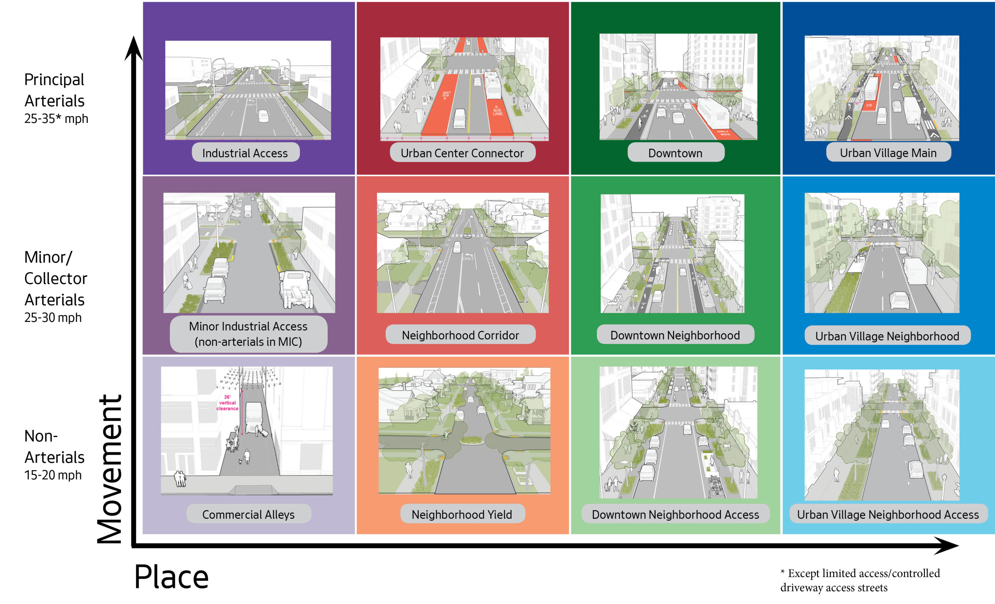
The City of Seattle has developed Street Types that are based on the adjacent land uses and envisioned character of the street in order to guide both future development and capital infrastructure projects. These Street Types provide a vision for, and more specific definition of, the design elements that support Seattle’s Complete Streets policies and respond to the diverse range of conditions throughout the City. They are intended to supplement the traditional functional classification system of streets, which define how a street should function to support the movement of people, goods, and services and provide access to property.
The traditional functional classification system focuses on use and operation (arterial, non-arterial, etc.). Street Types provide evaluative design features necessary to produce a street network that is responsive to the needs and desires of individual communities. These new street types are compatible with the City’s Comprehensive Plan, Seattle 2035 and Seattle’s modal plans. For example, the street type that is appropriate for a main commercial thoroughfare in the heart of Downtown is unlikely to also be appropriate for a small neighborhood commercial center, even though the functional classifications of those two streets may be identical.
The public right-of-way is a vital asset for the City of Seattle, comprising approximately twenty-seven percent of the city’s land area. The design and organization of the right-of-way is critical for ensuring that this asset can deliver the maximum level of benefit and return on investment to support the city’s goals for a safe, connected, affordable, innovative, and vibrant Seattle. The Street Types and design standards presented in the Right-of-Way Improvement Manual are intended to guide public right-of-way improvements with a focus on achieving these goals.
While Street Types portray a desirable vision for how the right-of-way design elements should be allocated, they are intended to be flexible given that context varies greatly throughout the city in terms of land use, built form, landscape, and modal integration. Furthermore, Street Types are not necessarily continuous along the entire length of a street; a single street may change type as the surrounding land uses and functions change. For example, a street may transition from a Neighborhood Corridor Street to an Urban Village Main Street as it passes through an Urban Center or Village, and then back to Neighborhood Corridor Street again. Prior to beginning street design on a capital or private development project, confirm the street type assignment by referencing the Street Type Map below:

